New tool maps where U.S. heat can pose threats to your health
The daily updated HeatRisk maps use color coding to show where the health threat from heat is highest. The website also offers tips for staying safe.

Last year saw brutal, record-breaking heat scorch much of the globe. Forecasts show that above-average temps are likely to hit most of the United States this summer, too. But one thing will be different in 2024: An online tool will be available that maps and rates the heat’s risk to health. It displays those risks using a convenient five-color scale.
Anyone in the United States can enter their zip code. Up will pop the current heat risk. It also will show “air-quality levels and a seven-day, heat-risk forecast for your area,” notes Mandy Cohen. “So, you can plan your day and you can plan your week with your health in mind.” Cohen directs the Centers for Disease Control and Prevention in Atlanta, Ga. She unveiled this new HeatRisk tool at a news conference on April 22.
Extreme heat kills more than 1,200 people in the United States each year, CDC estimates. That’s “more than hurricanes, floods and tornadoes combined,” says Rick Spinrad. He heads the U.S. National Oceanic and Atmospheric Administration (NOAA). Heat-related illnesses are even more widespread. Last year alone, they led to almost 120,000 emergency room visits. Too-warm nights also make it hard to sleep, upping the risk of accidents, poor work performance and more.
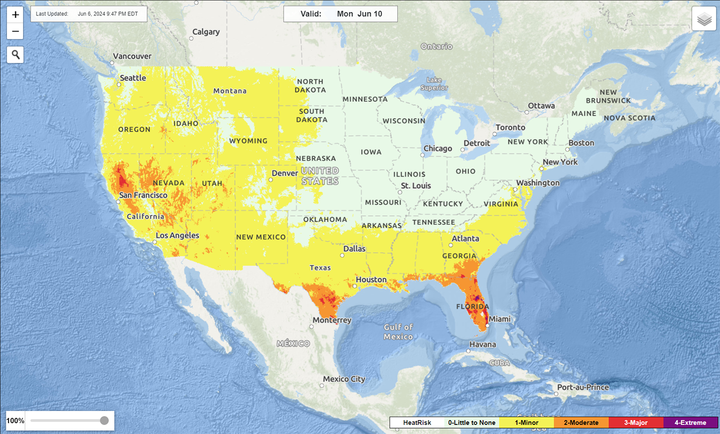
The HeatRisk maps are based on temperature forecasts from NOAA’s National Weather Service. They also include heat and health data from the CDC. As a package, they show where rising temperatures are likely to pose a threat to our health.
The maps rate risk on a scale that goes from pale green (for no risk) to deep magenta (for extreme risk). Those rankings are based on several factors. These include how unusual temps are for the time of year and how long an excess heat spell may already be. They also account for whether nights will offer a cool reprieve from the heat and whether conditions will likely be hot enough to impair health.
Users can zoom into the color-coded map and find local heat forecasts for the week. Another part of the site provides tips on how to spot signs of heat-related illness and how to stay safe. There’s even a Spanish-language version.
“When it comes to heat, it’s never too early to prepare,” Spinrad said.
What's Your Reaction?


![[Computex] The new be quiet cooling!](https://technetspot.com/uploads/images/202406/image_100x75_6664d1b926e0f.jpg)


